Regional Tick Map and Seasonal Explorer
Choose a species, location and month to explore published regional references. Maps show approximate distribution, while seasonal notes explain their limits. No live risk prediction is produced.
Explore a regional tick reference
Two blacklegged tick species, contiguous-U.S. range context and selected seasonal notes. These maps are not live surveillance, county classifications or a forecast.
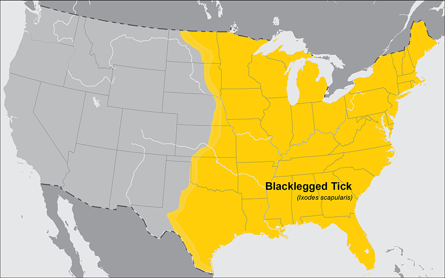
January · Eastern contiguous US
Winter is not an absence signal: adult blacklegged ticks may seek hosts on days above freezing. This is broad seasonal context, not a forecast for your location.
Read the seasonal sourceChanging the month does not change the range map. A shaded range is not a count of ticks, a pathogen test or a safety assessment.
For county-level records and observation dates, consult the original CDC maps. “No records” must not be read as absence or safety.
For an attached tick or symptoms after a bite, follow current public-health guidance and seek medical advice as appropriate. For pets, contact a veterinarian. CDC: after a tick bite.
Start with the map coverage
This version covers blacklegged and western blacklegged ticks. It is not a map of every tick species or a worldwide tick database.
Keep range separate from current activity
A regional range map describes broad distribution. Weather, habitat and sampling affect what happens in a particular place and time.
Use seasonal context carefully
The month selector gives source-based context where available. California western-blacklegged timing must not be extended to every Pacific-coast location.
Check the original surveillance source
County classifications belong in the CDC dashboard. Follow the source for its observation period and collection definitions before interpreting a record.
References
Related free tools
Frequently Asked Questions
Is this a live tick risk map?
No. It combines published regional references and seasonal descriptions, not current tick counts, weather forecasts or disease-risk estimates.
Does an unshaded location mean no ticks?
No. Broad range maps and incomplete records cannot establish absence.
Why does the map stay the same when I change month?
The map shows approximate range. Month changes only the separate seasonal context, where a suitable regional source exists.
Can it tell whether a tick carries infection?
No. Neither location nor appearance determines infection in an individual tick or a person.
Continue in the app
Use Tick Detector - Tickzen for the full guided result after this quick check.